Maxar Technologies has unveiled Sentry, a groundbreaking monitoring solution that aims to anticipate emerging threats by fusing live satellite feeds with decades of geospatial data. This new system, described by Maxar as delivering “predictive intelligence,” is designed to serve strategic operations by identifying worrisome patterns before they escalate into crises.
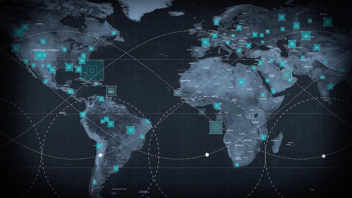
Sentry is offered in two tailored packages. Site Sentry concentrates on critical locations such as airports, seaports and urban centers, keeping constant watch over land and coastal zones. Maritime Sentry, in contrast, spans vast ocean areas, tracking vessel movements across thousands of square kilometers in real time. Both leverage Maxar’s 250‑petabyte archive of very high‑resolution imagery, collected over more than twenty years, to train advanced artificial intelligence and machine learning models. These models carry an intricate understanding of historical activity and global behavior, empowering them to spot anomalies like unexpected troop buildups, covert satellite launches or disturbances at key infrastructure sites.
According to Maxar CEO Dan Smoot, the push to develop Sentry stemmed from evolving customer requirements. “Delivering persistent monitoring of just one or two sites is no longer enough,” he explained. “Clients need to detect mission‑critical events anywhere in the world before they happen.” Sentry responds to that need by automating every stage of the sensor‑to‑decision process at a scale never before achieved.
At its core, Sentry weaves together three automated technologies. Proprietary collection orchestration software directs and schedules tasking across diverse satellite constellations, whether commercial electro‑optical systems or sovereign synthetic aperture radar platforms. This coordination dramatically expands coverage, allowing hundreds of sites to be monitored simultaneously. Next, automated geospatial production and data fusion convert disparate sensor inputs into a unified, time‑aligned representation of the earth’s surface, ready for large‑scale analysis. Finally, AI‑driven analytics apply state‑of‑the‑art object detection alongside third‑party systems to surface early warning signals for decision‑makers, either through Maxar’s Insights user interface or directly via secure API integration.
Sentry builds on technologies Maxar already demonstrated in support of U.S. intelligence and defense missions. Under the National Geospatial‑Intelligence Agency’s Luno A D01 task order, Maxar fused imagery and analytic tools to deliver AI‑generated object detections—identifying aircraft, ships, vehicles and railcars within hours of acquisition. That work, which enabled rapid count and classification of objects across multiple sites, formed the backbone of Sentry’s design.
Smoot described Sentry as more than a set of tools; it is “a mini intelligence agency” that grants clients early awareness and “decision superiority” when stakes are at their highest. Whether predicting an imminent satellite launch or assessing threats to energy infrastructure after a natural disaster, the platform promises to transform how military and civilian agencies monitor activity worldwide.
As geopolitical tensions continue to shift rapidly, the ability to fuse live observations with a rich historical archive offers a new level of situational awareness. By automating sensor tasking, data fusion and anomaly detection on a global scale, Maxar’s Sentry intends to put predictive power into the hands of those who must act swiftly and accurately, preventing small irregularities from slipping through the cracks and turning into full‑blown emergencies.